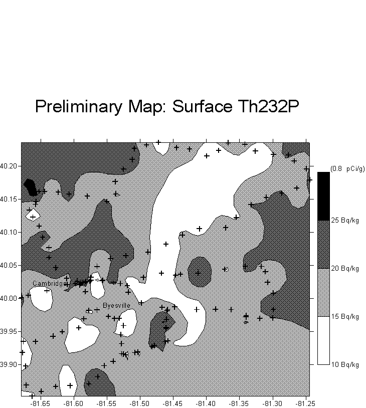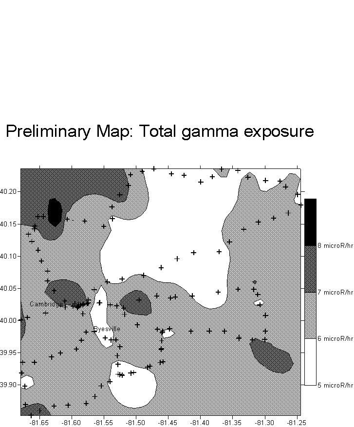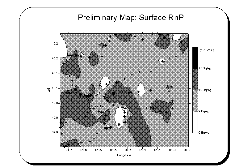
Observations: The measured surface radionuclide concentrations (RnP~0.3 pCi/g; ThP~0.5 pCi/g; K40~7 pCi/g) are in general agreement with the NURE data (see my 03/29/95 memo.) Surface radionuclide concentrations are consistent with sealed sample analysis of many of the offsite samples reported by the NRC. Total gamma ray exposure(~6.4 microR/hr) is consistent with the NURE data and the NRC microR meter #014808 and my microRmeter, a Ludlum model 12S #39351; last calibrated12-15-93.(an earlier version of model 19)